Raw Grit: PNG Bushpilot
Published by SimMarket / Pacific Islands Simulation
For FSX
Reviewed
by Joe "Mutley" Lawford
March 2009
Introduction
PNG, let’s expand on that, Papua New Guinea, lies just South of the Equator
just 86 nm north of mainland Australia. It is a former Australian
Protectorate that boasts more than 600 islands. The topography ranges from the
jungle-clad mountains of the highlands region to the white sandy beaches and
atolls of the coastal and island provinces. PNG Bushpilot has been designed
to open up this region to the aspiring and experienced FS bushpilot alike.
 |
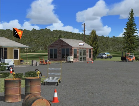
Once in a while a review product comes in that is slightly different from the norm. Raw Grit: PNG Bushpilot from Pacific Islands Simulation LLC is one of those products; not just the run-of-the mill aircraft, airport or photo scenery product but a reflection of a way of life.
PNG Bushpilot is essentially a playground for bushpilots to explore. A new
mesh, a collection of 23 airstrips (and an extra hidden one) from sea-level to high altitude (10ft -
8100ft msl) with very short to medium length runways and 10 seaports and
heliports (including helipads on cruise liners. |
Installation
This product is available only from Simmarket.com via download (or their
CD service). After
purchase, a download link is made available along with a key code to unlock
the product. The installer ran well and activated the scenery ready to go.
There is a pdf manual included which offers invaluable information on each
airstrip and local advisories as well as a suggested tour and region maps.
Area covered, airstrips and terrain.
Raw Grit: PNG Bushpilot comes with its own 76m mesh which covers the
whole of the region from longitude E141 to E160, and latitude S1 to S13. It was
derived from NASA's version 2 SRTM3 data, and has been processed to fill all
the voids. While SRTM data is never perfect, it is indeed a substantial
improvement to the default terrain and it is as good as reality according to
real-world bushpilots.
All the airstrips listed below have notable advisories, be it an active
volcano nearby, threshold displacement, sloped runways, bumpy runways or bird
hazard. The seaports have their own hazards too such as birds, dolphins,
whales and local fishermen.
| Airstrips modelled | Seaport? |
|
| TOKUA (AYTK) | ||
| SULE (SULE) | ||
| BIALLA (BIA) | ||
| HOSKINS (AYHK) | ||
| TALASEA (TLS) | ||
| CAPE GLOUCESTER (CPG) | ||
| WASU (WASU) | ||
| KEGLSUGL (KEG) | ||
| KEREMA (AYKM) | ||
| TAPINI (TAP) | ||
| FANE (FANE) | ||
| WOITAPE (WTP) | ||
| TUFI (TFI) | Y - TUFI (TFI) | |
| VIVIGANI (VIV) | Y - VIVIGANI (VIV) | |
| SALAMO (SAO) | Y - SALAMO (SAO) | |
| ESA’ALA (ESA) | Y - ESA’ALA (ESA) | |
| BULOLO (BUO) | ||
| ZENAG (ZEN) | ||
| FINSCHAFFEN (FIN) | ||
| GASMATA (GMA) | Y - GASMATA (GMA) | |
| JACQUINOT BAY (JCB) | ||
| GONAILI (GON) | Y - GONAILI (GON) | |
| TOL (TOL) | Y - TOL (TOL) |
Performance & settings
The developers are sensitive to the processor requirements of FSX
so this scenery was developed and tested on a low end machine.
The system requirements echo this making it an ideal add-on for anyone
upgrading from FS2004 to FSX. The requirements are as follows-
• Microsoft Flight Simulator 10 (FSX)
• Windows XP (SP2, SP3), Windows VISTA
• Pentium IV 2.6 GHz (2GHz Duo2Core Intel or equivalent advised)
• 1 GB RAM and above
• 256 Mb DirectX 9 graphics card (512 Mb recommended)
• Adobe Acrobat® Reader 6 minimal to read and print the manual.
• 160MB of disk space
The developers recommended settings for FSX should be suitable for most PC’s.
As ever, tweaking the display options will be unique to your machine but the
recommended setting for the autogen is to be set to dense otherwise the scenery becomes
unrealistic.
Road traffic should be set at no higher than 7% otherwise the country roads
will be too busy compared with the real world. The developers have also slowed the
traffic down by 40% to 60kph in order to reflect the slower pace of life.
Ships and leisure traffic are recommended to be set to 20%, personally I
upped this as marine traffic is probably the most important type of traffic
after aircraft in this region.
 |
A personal note from the developer quotes that there were
over 500 customised objects using versatile techniques to reduce frame rate
hits considerably. This means using very few vertices and polygons,
and adopting gmax's spline method heavily in designs without compromising
quality. |
Using PNG Bushpilot
If you need some ideas what to do then take some of the 23 flights
illustrated in the manual. These will take you around all the airfields so
you can get acquainted with the region. Alternatively, if you have a flight
generation program such as AirHauler then you could set it up to be very
localised and generate cargo flights to your airports. Indeed, if you look
at the airstrip at Bulolo you will find an AirHauler hangar with the
appropriate logo on the board!
You can also fly seaplanes as there are plenty of seaports to visit or, if
you are a helicopter fan you can ferry passengers from cruise liners to the
shore but for me hauling cargo in the bush is my favourite so that’s what I am
about to do.

I started off from the highest airstrip in the series, Keglsugl. At 8100ft
mixture settings need to be considered as the air will be a lot less dense
up here and the engine will not run as smoothly. VFR is the name of the game, sure you have your GPS to help guide
you but navaids are few and far between. There is a NDB here with a 100nm
range, I set that first!
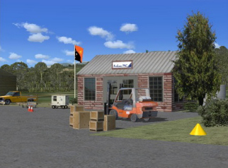
Once airborne, the first thing I noted is that the strip is not near a big
village so the airstrip itself is not densely packed with buildings,
only the buildings necessary to service an aircraft or dispatch passengers,
again this is how it is in real life. The vast majority of the
runways are grass and dirt and can be very bumpy so you could end up bending
your suspension if you have your terrain resolution setting too low!
Right after departure you have to turn to take avoiding action as straight
on you could be trimming the vegetation.
The location of some of these airfields call for true bush pilot skills,
some of the approaches within the mountainous regions as shown in the
"Missionary Freight Run" region above are real fun to fly, if not for my
passengers, definitely for me!
With the enhanced mesh, the mountainous regions look a lot better than the
default. What helps it to look nice is the jungle vegetation which can
be as dense or as sparse you like (or can run).
|
|
|
|
|
|
|
|
|
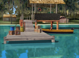
This scenery is not just about the mountains. In the intro above I
mentioned the coastal regions. There are some nice seaports, some with
buoys to mark out an approach channel. Approaches to some of the
airstrips can be over the water too so you will see quite a lot of wildlife
with birds and sea mammals breaking the waves.
When you have your seaplane moored up at the pier waiting for your
passengers you can listen sound of lapping waves whilst contemplating your
flight or writing your PIREP.
There are so many little details and nice touches that it is difficult
to list them all. Each one is in keeping with its location and on
occasion have their own story to tell. A bent aircraft for example or a burnt out
car hint of their past life. A sleepy beachside village on stilts welcomes
the tourists, a volcano spews its molten contents, dive resorts, lumber
depots, on and on, all nicely illustrated.

Conclusion.
PNG was not a region I would have ordinarily bothered with, but I am glad I
have. This scenery really opens it up, "Raw Grit" is a good
description, it's tough out there!
Whether you are running a cargo operation, passenger ferrying service or
just here for the sightseeing, PNG Bushpilot could be for you.
Some comments have been made about the lack of, or the placement of, the
scenery at the airstrips but I found it to have just about the right balance
of entertainment and realism and would highly recommend it.
Although Pacific Islands Simulation created over 23 airstrips and seaports,
I did not encounter any technical issues involving texture, blurriness,
compatibility issues, CTD, etc. In fact, according to the developer, he is
yet to receive complaints about the product. After-market support is every
developer's main contention and since he is yet to receive any complaints, I
can safely assume that the product was thoroughly tested for public release.
Finally, as of writing, the developer has began work on an expansion pack
which would include over 10 high altitude airstrips. The expansion pack will
be free-of-charge for those who purchased the basepack.
LINKS


