ardmorepilot
-
Content Count
10 -
Joined
-
Last visited
About ardmorepilot
-
Rank
Ground Staff

-
Cheers guys!
-
Hi guys, I've been really enjoying the new Real Air Duke V2 recently. It's not often I feel the urge to share my FS screenshots, but I just couldnt stop hitting the V key on my latest flight. The Duke has all the right angles for me, and the VC has to be the highest quality GA interior I've ever had loaded onto my system. The route I took was NZWN to NZHK, via WB VOR and NS VOR, for an NBD/DME 21 approach. Scenery installed below was Orbx's NZNI and NZSI, in conjunction with REAL NZ's payware Woodbourne and Nelson photoreal airports, and their 2013 freeware Hokitika as my final destinatio
-
On kiwi TV at the moment, there's an epic documentry series airing called 'New Zealand from Above' with plenty of inspiring high def in flight footage around our scenic back country. I thought it would be a fun idea to take Carenado's latest offering, thier Cessna C206H, up on a cross country flight through flight through the South Island's Alpine Faultline valley systems that were featured on last weeks episode. This is a map of the route, if anyone wants the .PLN file with the custom GPS waypoints, just let me know below. Takeoff from Woodbourne (NZWB), and pick up the wide braided
-
Thanks guys, will add some more soon!
-
NZHN – NZAP – NZTN – NZTM – OH – NZNP (210nm) .PLN and .PLG download This is a much abbreviated version of the two and a half thousand word flight guide that I've written for an upcoming edition of PC Pilot magazine. Make an easterly departure from Hamilton International, intercept the Waikato River and follow it as it curves south east around the prominent forested volcanic cone of Maungatautari. To immerse yourself in the scenery, stay low to the water, and match its path towards Lake Taupo, the largest lake in the North Island, that feeds it flow. Enjoy the sculpture of the gorges, but
-
NZAR – NZHN – NZRO – NZTG – NZAR (215nm) .PLN and .PLG download Known as the Milk Run at the flying school I started out at- it sends pre PPL students from their home uncontrolled aerodrome base round a big circuit to three larger domestic airports all with control towers on watch to help out if the students start getting lost. Load yourself at runway 21 at Ardmore, roll ahead and make a left turn onto 141°M after takeoff to scoot along the western fringe of the Bombay Hills- the southern border of Auckland city region- to intercept the Waikato River. Stay below 2500ft to remain clear of
-
NZHS – NZYP - NZDV – NZMA – NZWN (175nm) .PLN and .PLG download Hastings is a city twinned with nearby Napier (20km away), which was the final destination in the first flightplan I added to this thread. Hawkes Bay Airport serves turboprop airliner traffic from Wellington and Auckland, but Hastings’ own smaller airfield is exclusively used for general aviation. We want to line up on runway 01 (sealed), making a right turn after takeoff to climb directly over the centre of town. Roll out with your nose pointing to the south east, and track overhead the CBD to the Tukituki River, 6 miles away
-
NZPI – NZWR – Paihia – NZKK (130nm) .PLN and .PLG download Parakai aerodrome (now officially known as West Auckland Airport) is actually a good 45 minute drive away from the central Auckland, but is the closest GA airfield to the city that offers a skydiving dropzone to the thousands of visiting tourists. Line up and roll from the 760m easterly facing runway (07) and continue on this heading as you climb up to around 2000ft. We’re looking for State Highway 1, which runs out of Auckland right up to Cape Reinga, and like the last flight, we’re going to intercept it, and follow it to our next
-
NZAP – NZRK - NZNR (65nm) .PLN and .PLG download Something relatively short and simple to start with. I suggest downloading the highly detailed ex-payware, now freeware, Taupo Airport scenery from fs-creations.org (Orbx compatible) for our first spawn location. Make a southerly departure from the high altitude lakeside airport (1335 ft AMSL), and climb up to a moderately low cruise altitude of 3000ft. Fly the runway heading (170) for five miles along the coastline of the aptly named Five Mile Bay, then make a left turn to make a direct track to Rangitaiki. NZRK is a small grass strip next t
-
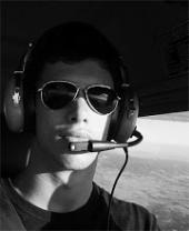
Hi everyone, Long time lurker- first time poster here. I’m a ‘real world’ commercial pilot from NZ, and have been a frequent visitor to this website every time I search a FSX addon review! Recently, I’ve really been enjoying the FTX NZNI package from Orbx and thought I’d start up a topic here detailing a collection of scenic VFR flight plans that I’ve created to show off the part of the world that I’ve spent over 600 'non simulated' hours exploring and enjoying. I've also posted a copy of this thread over on their official support forums, but thought it wouldn't hurt to share my posts here too