rosariomanzo 545 Posted September 22, 2013 Author Report Share Posted September 22, 2013 Back on track. We spent 7 months here... WOW, seven months! Seems yesterday we put the wheels on the ground. Life has been nice, really: nice place, nice food, nice wine, nice beaches and nice girls! We also found an italian restaurant, Gino's (I guess most of italian restaurants around the world have this name). Gino took care of us with pounds of spaghetti and other typical italian food. Aah, the babà cake! Well, it's time to leave. At the airport, a crowd of friends is looking at us behind the windows. According to P G Taylor's flight log, we should now head to the Island of Mangareva. The nearest airport, a bunch of miles North, is Totegegie, NTGJ. It's something like 850 NM over the Pacific Ocean, so we decided to split this big flight in four legs of about 200 NM each. So the flight plan to Mangareva will be: Faaa, NTAA - Anaa, NTGA - Hao, NTTO - Tureia, NTGY - Totegegie, NTGJ Everything is ready. It's been a bit hard to spool these engines after such a long stop. Running her up: And up we go, ciao ciao Tahiti! Sigh... The last sight to this wonderful Island: On track, 5.000': A view on the placid Pacific Ocean: We are about to reach Anaa: Looks nice: We'll join the left traffic pattern to land on runway 14: On final, where will that long bridge lead? A nasty crosswind and seven months away from the cockpit are the right ingredients for a far-from-perfect Landing Anyway, we are safe on ground. We will leave soon to the next Island. See you there, thanks for watching! Link to post Share on other sites
mutley 4,487 Posted September 22, 2013 Report Share Posted September 22, 2013 Bravo Ros, it's great to see you on your way again, I was unsure you would be able to take off after all that babà cake! Super shots and commentary, looking forward to more.. Caio! Joe Link to post Share on other sites
rosariomanzo 545 Posted September 24, 2013 Author Report Share Posted September 24, 2013 And here we go again for another short hop.Next stop: Hao, French Polynesia (NTTO).A view of our office, don't you love this view?After departure, we perform a right traffic pattern and head east:All the Needles, the bells and the whistles look ok:Reitoru Island and...... Marokau Island:Field in sight, we descend 1.000' and take a look at the windsock:Downwind leg:This time we are going to gently touch the runway, even if a 10 kts crosswind is strong enough for this bird:Time to close the office!Our trip as of today, 4.187 nm:YSSY (33°56'46"S 151°10'38"E) NWWW (22°00'59"S 166°12'58"E) 52.0° (NE) 1069 nmNWWW (22°00'59"S 166°12'58"E) NFFN (17°45'19"S 177°26'36"E) 70.1° (E) 684 nmNFFN (17°45'19"S 177°26'36"E) NFTF (21°14'17"S 175°08'14"W) 117.5° (SE) 469 nmNFTF (21°14'17"S 175°08'14"W) NCAI (18°49'51"S 159°45'51"W) 83.3° (E) 880 nmNCAI (18°49'51"S 159°45'51"W) NTAA (17°33'24"S 149°36'41"W) 84.1° (E) 585 nmNTAA (17°33'24"S 149°36'41"W) NTGA (17°21'18"S 145°30'30"W) 87.7° (E) 236 nmNTGA (17°21'18"S 145°30'30"W) NTTO (18°04'29"S 140°56'45"W) 100.0° (E) 265 nmTotal: 4187 nm Link to post Share on other sites
brett 2,283 Posted September 24, 2013 Report Share Posted September 24, 2013 That's a healthy trip so far. Been enjoying the ride along. Link to post Share on other sites
Quickmarch 488 Posted September 24, 2013 Report Share Posted September 24, 2013 Go for it Ros! I'm enjoying every minute. Hats off to you for all the time and energy required to fly something that slow, that far. Link to post Share on other sites
rosariomanzo 545 Posted September 25, 2013 Author Report Share Posted September 25, 2013 Thank you for encouragement guys! I have some holydays, hope to reach Easter island soon! Link to post Share on other sites
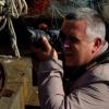
rosariomanzo 545 Posted September 27, 2013 Author Report Share Posted September 27, 2013 Here we are for another shot hop. Next stop will be at Tureia, French Polynesia (NTGY). Taking off early in the morning: A shot taken by Gennaro, the copilot: I love this shape: The little airport of Tureia is in sight. Looks like we are going to park on grass. Performing the traffic pattern, i feel the engine is not behaving as usual. Land was a bit on the 'too fast' side: the brakes of this Aircraft are not so powerful and we had to run the Whole runway to stop. - "Hey Gennaro, looks like someone is cooking some fish nearby, huh?" Then Gennaro suddenly jumped out of the Aircraft, I've never seen him running so fast. That's why: Fire has been rapidly extinguished, but we have to investigate for any engine damage may have occurred. It won't take too long, Gennaro is a great mechanic. I'll spend some hours fishing... Our trip, so far: Link to post Share on other sites
mutley 4,487 Posted September 27, 2013 Report Share Posted September 27, 2013 Looks like a good opportunity to take a short brake Ros, those radial engines sure do get temperamental when hot! Link to post Share on other sites
brett 2,283 Posted September 28, 2013 Report Share Posted September 28, 2013 Only thing to put the fire out around there is coconut juice. Hope there are no big problems to deal with and you can get on your way. I'm sure Gennaro will expect a fish fry for dinner so good luck on your fishing trip. Link to post Share on other sites
rosariomanzo 545 Posted October 31, 2013 Author Report Share Posted October 31, 2013 Gennaro did a perfect job after the engine fire occurred at the end of our last flight. After some days spent in this little paradise, I thought it would be nice to make some Halloween party in Mangareva. And our Black Cat seems appropriate indeed. So, it's time to leave again! Roaring away Heading east to our next destination Cruising over the Pacific Ocean Trying to experiment some new fast cruise settings, hoping not to burn engines again. The Cylinder Head Temp is quite high, but acceptable. We are cruising at about 130 kts. Our main visual reference, a series of little atolls and islands. We will fly over Tenararo and Vahaga Atolls, then Minto Island. Last piece of this little Group, Mature-Vavao Atoll: Only a NDB to reach Totegegje airport: Here we are, Mangareva Islands and Totegegje airport on the left: A few feet before touchdown. Nice attitude! At destination, we now have to look for some halloween costumes. Our route, so far: Thanks for watching! Link to post Share on other sites
Ruzzo 59 Posted October 31, 2013 Report Share Posted October 31, 2013 Superb screenshots, Rosario. Love the water in that fourth one. Link to post Share on other sites
rosariomanzo 545 Posted October 31, 2013 Author Report Share Posted October 31, 2013 Thank you Paul! Link to post Share on other sites
hifly 925 Posted November 1, 2013 Report Share Posted November 1, 2013 You sure get around Rosario. Link to post Share on other sites
rosariomanzo 545 Posted November 9, 2013 Author Report Share Posted November 9, 2013 Me and Gennaro have spent all day planning and preparing the Aircraft for the next long leg to Easter Island. There are almost no visual references and a single VOR at Easter Island, way too far for a 10 hours flight! So we will have to fly east, hoping the winds will be helpful, and fly 10 hoursjust to reach the VOR signal. A single error and the situation won't be nice. I have a bad feeling about this. Anyway, we decided to wake up early, to be at SCIP at about 18:00. Fuel is enough to reach Easter Island. While I setup the Aircraft for startup, Gennaro keeps asking me if we really need the sextant I have put in my bag. Taking off at 06:18 AM: This is quite a nice view: That should be easy enough, follow the sun! Keeping the same track over the calm ocean: Time is running: We are lucky enough with the weather: Autopilot is on, Gennaro takes this shot of our office while I'm busy in the toilet : The bad feeling becomes frustrations as I look at the fuel gauge. At this point, we should have the VOR alive, but the needle is not giving us any sign: Something has gone wrong, fuel is low and it's becoming dark outside. Better get her down. We have some reserve fuel tanks aboard, and I guess now Gennaro has understood how useful will be my sextant: Floating in the middle of the ocean with some sharks fins around! We will wait for the stars to understand our position, eat something, refuel the Aircraft and sleep a little. We will leave Tomorrow again. Thanks for watching! Link to post Share on other sites
rosariomanzo 545 Posted November 10, 2013 Author Report Share Posted November 10, 2013 *YAWN* 'morning Gennaro, ready to go? According to our calculations, we are here, about 250NM South of Easter Island (that little dot in the blue blue sea): So we are not so far. Let's get her started after a night spent floating in the Pacific Ocean: And up we go, heading North: The low rising sun: And it's a pleasure to have the VOR needle alive now! And, after a while... Rapa Nui! I've Always been fascinated by the story of this Island and its civilization. It's the story of the limits that nature gives us. You cut the last tree, a whole people disappears. Take care of the world you live in guys. Down with a strong headwind which shakes our big wings: Time to take my camera and walk around the Island to grab some nice shots. Our route as of today: We are now one pace away from destination, Valparaíso. See you soon! Link to post Share on other sites
Ruzzo 59 Posted November 10, 2013 Report Share Posted November 10, 2013 Good job that you don't get sea sick whilst on the water. Superb screens and two great legs. Making me more and more want the Cat, is she a sweet bird to fly? Link to post Share on other sites
rosariomanzo 545 Posted November 10, 2013 Author Report Share Posted November 10, 2013 One of the finest and most realistic aircraft i've ever flown, and one of those which don't get much dust in my (wide) hangar Link to post Share on other sites
mutley 4,487 Posted November 10, 2013 Report Share Posted November 10, 2013 I agree Ros, she is a beauty as we can see from your adventure, I am really enjoying this thread. Link to post Share on other sites
rosariomanzo 545 Posted November 15, 2013 Author Report Share Posted November 15, 2013 We won't be able to reach Chile today. Even if the Cat has a respectable range, we should fly more than 15 hours to see the South american coasts. So we will head to Crusoe Island, which is only 12 hours away It will be dark when we will arrive, and I guess we won't be able to recognize the airport. No problems, plenty of water to give some rest to the Cat! Full fuel tanks, and we are ready to go: A challenging crosswind takeoff: Leaving Easter Island, we've spent some nice days here: Dark shape and White clouds: Our faithful right engine, you'll have to spin a lot today! The blue blue sea: Watching the moon rising, Gennaro says something about a November screenshot theme, which I don't quite understand : Oceanic sunset; Night view of our office: We have the NDB alive, but visibility is prohibitive: Really can't see the airport, better turn left to the moonlit wide ocean: Ready to spend another night floating : We'll stay here tonight, near terrafirma: Valparaíso is waiting for us, see you soon (and good night)! Link to post Share on other sites
Ruzzo 59 Posted November 15, 2013 Report Share Posted November 15, 2013 Another great leg. I think you've convinced me to get the Cat now, Rosario. That cockpit.. Link to post Share on other sites
rosariomanzo 545 Posted November 15, 2013 Author Report Share Posted November 15, 2013 I'm sure you won't regret. Treat her with gloves, she doesn't forgive bad engine management! The only issue I have is with the DME which doesn't turn on, but it doesn't spoil the experience. Link to post Share on other sites
brett 2,283 Posted November 16, 2013 Report Share Posted November 16, 2013 Great pic's in this leg Rosario. Nothing like sleeping on a water bed. Link to post Share on other sites
hifly 925 Posted November 16, 2013 Report Share Posted November 16, 2013 Nothing like sleeping on a water bed. Wrong verb Brett. Great adventure Ros. You're a good salesman for the Cat, I'm tempted to get one too. Link to post Share on other sites
diverone 1 Posted November 16, 2013 Report Share Posted November 16, 2013 thanks for the trip pictures look great and the story too...... Link to post Share on other sites
Quickmarch 488 Posted November 17, 2013 Report Share Posted November 17, 2013 Thanks Rosario, This is a truly great trip. Carry on. Watch out for those Chileans. They speak like they have rocks in their mouths - very hard dialect to decipher. Link to post Share on other sites
Recommended Posts
Please sign in to comment
You will be able to leave a comment after signing in
Sign In Now