Introduction and a bit of History
I first came across Narsarsuaq in Ernie Gann's autobiographical book, "Fate
is the Hunter". In the chapter called Valhalla, he flies
into Bluie West One, as it was then called, in an Air Transport
Command C-47. Sounds straightforward enough, except for the
foggy overcast that meant the approach up Ericksfjord had to be
made at less than 200 feet... 'Wonder what it looks like in
FSX?', I thought, only to be thoroughly disappointed, as usual,
with the blandness of M.S. default scenery. Determined to find
something better, I came across FlightSim.gl, and read about
their Greenland-X scenery and mesh development. Nuuk-X, the
capital city's airport and surrounding area, was already
available, but I would have to be patient as Narsarsuaq-X was
still in the design stage...
Well, the waiting's over, and I can tell you that it was well
worth it! Ulrik Motzfeldt and his team have produced one of the
finest mesh and scenery combinations that you'll find anywhere
in the flight-sim world - and it's free. With Narsarsuaq airport
(BGBW) at it's centre, the scenery extends to more than 13,000
square miles and includes 10 settlements complete with
helistops. A further 10 locations of interest, including a gold
mine, hydro-electric plant and other small villages, make this
South Greenland area an exciting proposition for exploration by
helicopter or bush pilot.
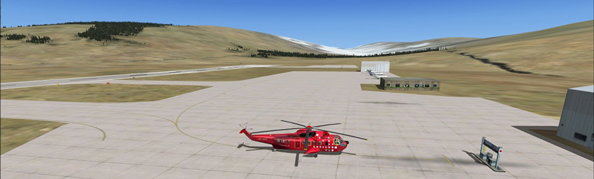
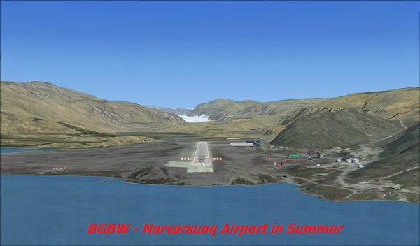
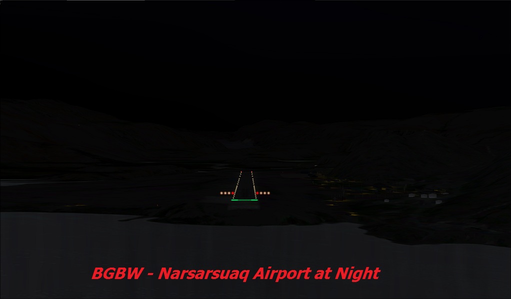
Just to whet your appetite, here are a couple of screenshots.
The first is of Narsarsuaq airport.

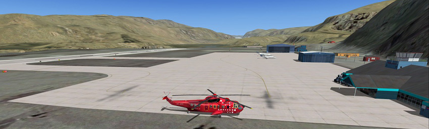
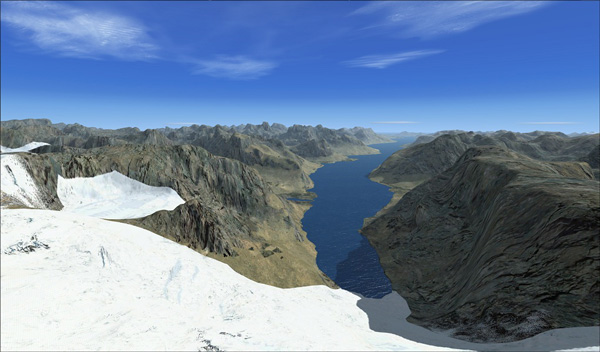
Looking west from the hillside
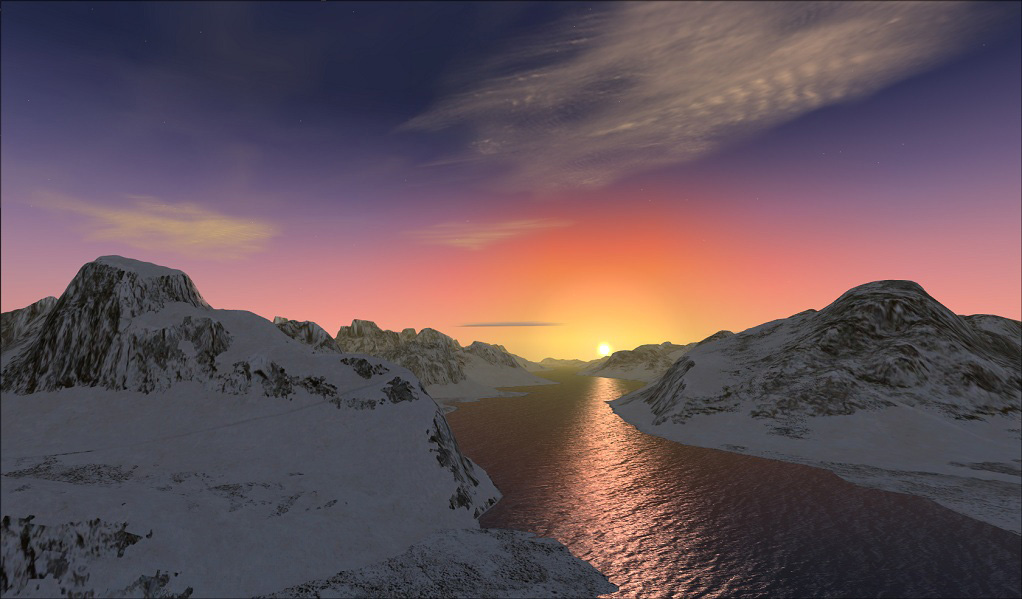
Sun setting over Tasermuit Fjord
Download and Installation
Narsarsuaq-X is one of several high quality offerings from FlightSim.gl (see
below for link), started a few years ago by a group of local
enthusiasts. Before downloading Narsarsuaq-X, you may choose
between installation paths: Auto or Manual Install. Both
download zips weigh in at around 220 Mb, so give the server
time! I chose the Manual Install, and, after un-zipping, I found
3 folders containing scenery and missions, and an installation
'readme' giving detailed instructions - a very straightforward
process. After installing, but before activating new scenery, I
like to be in position to see the changes, so I fired up FSX and
located myself by the fuel at BGBW. 'Same old same old...', I
thought, ' you could
be anywhere in the world - except, perhaps, Greenland!'
Then I opened the Scenery Library, to add Narsarsuaq-X from where it was
installed in Add-On Scenery. After persuaduing Windows 7 that it
really was O.K. to activate the new scenery, it appeared at the
top of the list and I returned to the sim - to find...
I think you'll agree that this is a distinct improvement on the default!
Let's take a quick look around.
Narsarsuaq Airport and Town
'Narsarsuaq' means 'The Great Plain', in Greenlandic (related to Inuit), and
it's about the only flat area in Southern Greenland big enough
for an airfield, which was the reason Bluie West One was built
here in 1941, as a staging post for trans-Atlantic flights.
Around 150
people live and work in the airport area, where there is also a
hotel, hostel, shop, café, a nursing clinic and kindergarten.
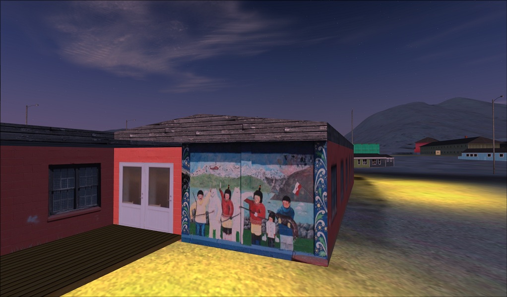
Here's an
example of Mads' attention to detail:
Most of the building models in Narsarsuaq-X have
been designed by Mads Petersen, who lives in Narsarsuaq
and works at the airport.
Visitors to
Narsarsuaq generally arrive by air, and either base
their vacation here or fly by helicopter to their chosen
venue.
Air Greenland has a number of aircraft and helicopters
based at BGBW, serving the outlying settlements and
tourism activities.
![]()
Supplies are brought
in by ship to the dock on Ericksfjord and transported by
road to the township and the airport.
The standard of
scenery object buildings is very good - Mads has used
photo-textures wherever possible to create a most realistic
result. The colour schemes are varied and bright, just like the
real Greenland. The scenery has no people - this isn't such a
bad thing as I'm always surprised how that nice Japanese
business man with the mobile 'phone seems to crop up all over
the FSX world! I prefer to use my imagination...
Southern Greenland and Narsarsuaq-X Area
The area covered by Narsarsuaq-X lies between Latitude N 59.75/span>° and N 62°, and Longitude W 44° and W 47.5° - approximately 13,000 square miles.

In addition to the
main airport, BGBW, there are 10 heliports:
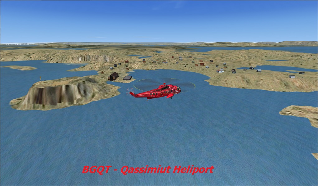 |
BGQT -
Qassimiut: the smallest settlement in
Greenland - population 29 (in 2010). |
 |
BGNS -
Narsaq: one of the larger settlements,
with more than 1500 inhabitants, Narsaq has the only
livestock slaughterhouse in Greenland, mainly lamb and
mutton. |
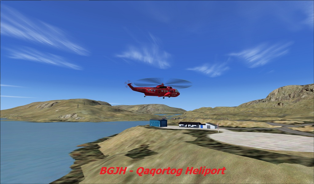 |
BGJH -
Qaqortoq: twice the population of
Narsaq, this is one of the earlist Saqqaq sites in
Greenland, with artifacts dating from 4,500 years ago;
today, Qaqortoq is a seaport and trading station as well
as an admistrative centre for the area. |
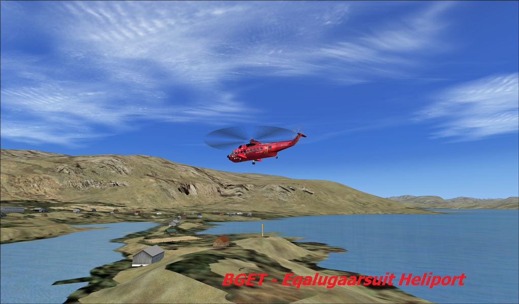 |
BGET -
Eqalugaarsuit: a small settlement
surrounded by a dozen sheep farms. |
 |
BGAP -
Alluitsup Paa: a settlement with
geothermal springs and the remains of a nunnery. |
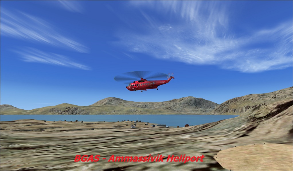 |
BGAS -
Ammassivik: another small farming
settlement further up Siglufjord. |
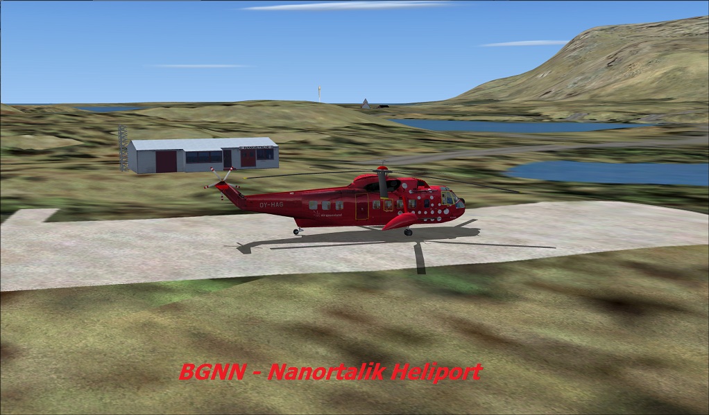 |
BGNN -
Nanortalik: one of the first Inuit
settlements in the area, Nanortalik means 'Place of the
polar bears'. The town has nearly 1500 residents and is
a popular destination for climbers - sheer granite faces
abound both on the island and further along Tasermiut
Fjord. |
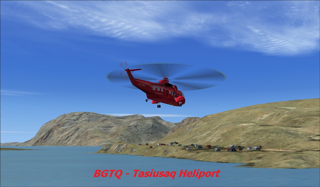 |
BGTQ - Tasiusaq: a farming settlement near Nanortalik and a trekking and climbing centre. |
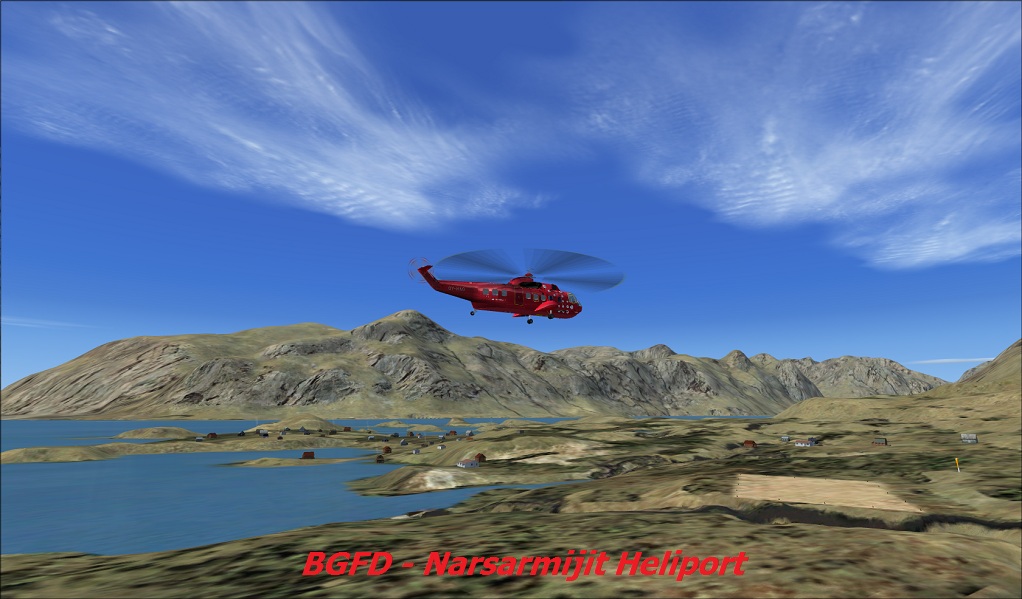 |
BGFD - Narsarmijit: a small sheep farming community roughly 30 miles north of Cape Farewell, Narsarmijit is the most southerly settlement in Greenland. |
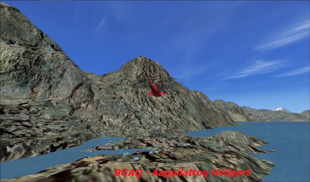 |
BGAQ - Aappilattoq: a fishing village with 130 inhabitants at the eastern edge of the Narsarsuaq-X area. Aappilattoq means 'Sea anemone' in Greenlandic. |
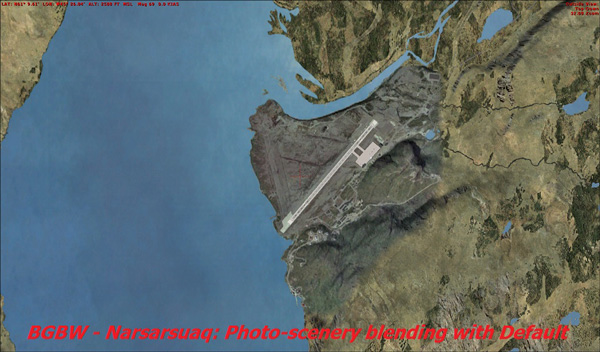
Narsarsuq-X Photo-scenery and Seasonal Effects
The area immediately around BGBW Narsarsuaq airport uses satellite
photograph textures for both summer and winter.
The photo-textures have been carefully blended with the adjoining default scenery to give a seamless interface for both summer and winter.
The land class textures for the default scenery have been carefully chosen
to represent the true nature of the area and much of the
auto-gen flora removed to increase realism.
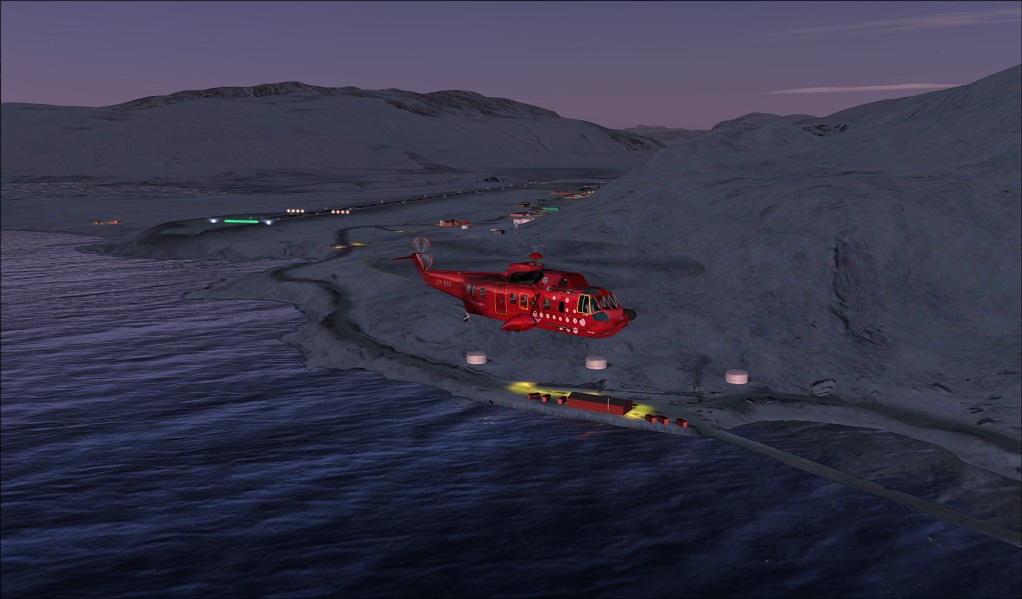
At night, the runway is lit with approach lights for runway 07. There is no ILS but the NA (Narsarsuaq) NDB has a range of 37.5 miles - on approach, you uses the 073-degree radial. Here's a view of this at night.
New Greenland Mesh
A new mesh for the South Greenland area has been developed from the ASTER
Global Digital Elevation Model source data. GDEM is the result
of collaboration between the Japanese government and NASA and
has been acquired from the ASTER sensor, carried by the Terra
satellite.
ASTER
captures high spatial resolution data in 14 bands, from the
visible to the thermal infrared wavelengths, and provides stereo
viewing capability for digital elevation model creation.
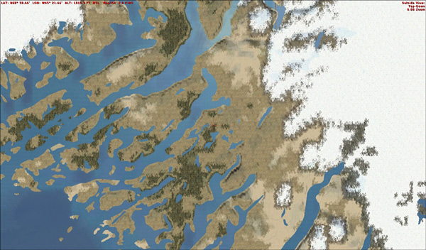
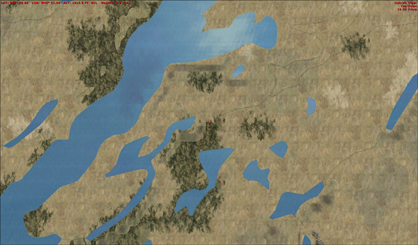
In addition, the FSX coastline and islands have been
reworked for this release by
Ulrik Motzfeldt, who has also added the numerous
glaciers. The
lakes and streams come courtesy of Lars Larsen and Finn Olesen. Here
are a couple of comparisons between the original default
coastline and lakes, compared with Narsarsuaq-X:
The resulting scenery is quite breathtaking, as you will agree when you look at the following screenshots of Tasermuit Fjiord in summer and winter.
Missions
The Missions included in the initial Narsarsuaq-X release were developed
using Instant Mission Maker and are designed to give you an
opportunity to discover for yourself the Narsarsuaq-X area.
Unfortunately, for me at least, the development team have used a
Danish version of FSX and the Lat/Lon co-ordinate characters
were unrecognisable in my English version! Ulrik assures me that
this will be recitified shortly and the revised Missions, along
with a few more that are currently in development, will be
available for download from the FlightSim.gl website.
Pluses and Minuses
Narsarsuaq-X is an excellent base from which to explore Southern Greenland -
an area most flight simmers know very little about, but where
you'll enjoy a combination of glorious scenery and very exacting
weather conditions. Anyone interested in flying the North
Atlantic Air Ferry Route, from WWII, is bound to prefer the GDEM
mesh to the default, despite the modern airport buildings
possibly detracting from a wartime atmosphere.
At first, I found the scenery buildings too colourful for my taste, however,
I had to revise this view when I saw photographs of the
settlements themselves. Believe me, the houses are just as
colourful in real life!
Adding Missions to encourage users to explore the scenery is a great idea
and I look forward to the revised versions to be made available.
![]()
|
Verdict It's been a real pleasure writing this Review of Narsarsuaq-X. O.K., I was hooked on the area before I started, Bluie West One in particular, and I was delighted that this excellent piece of freeware from FlightSim Greenland met my expectations entirely. Narsarsuaq-X attains a higher standard than many payware sceneries . |
 |
| I therefore can wholeheartedly recommend it to you and award the 'Mutley's Hangar Award for Excellence' and a 10/10 rating. | |
David Williams
Review machine Spec: Q9400 2.67 GHz |
4Gb Ram |nVidia GeForce 8800 GT 512 Mb |Windows 7 64bit