
For those of us who like to fly by the book when
approaching airports or flying online, there is something quite
satisfying about knowing you have flown the approach pattern and
landing procedure by the book. We'll look back at the flight track
on the FSX flight analysis window and smile at the line drawn by
the route we have flown.
But are well really as good as we think we are? This is where
GeoApr comes in.
GeoApr (Short for Geo‐Referenced Approach Plates) is a new utility
from Flight 1 that will allow you to see the position and track of
your aircraft on the approach plate and also the vertical profile
when landing. Several years ago Jeppensen had a similar program
call 'Sim Charts' which tracked your path along the approach
plate, but not the vertical profile. This is a utility that has
been missing for a long time in FSX, let's see how it measures up.
Download, Installation &
Documentation
As with all Flight 1 products the product is downloaded
and installed via their flawless 'Wrapper' system. This doesn't
take very long at all as GeoApr is only a 9.6mb download (that's
not a typo).
Once installed the program shows up in your Flight One Software
folder in the Start‐‐> Programs menu. I've pinned the shortcut to
my start menu as I use it a lot. In total I was ready to go in
around 15 minutes.
This was when I became a little confused as there were only a
handful of approach plates included with the download. After
consulting the manual it became apparent that I needed to download
the approach plates I wanted myself and geo‐reference them
manually before they would work.
Initially I was a little annoyed at this, but thinking about it
logically it makes sense. This way I am only downloading the
charts that I need and my hard‐drive is not getting clogged up.
I've got into the habit of downloading the approach charts for the
approach I will be using prior to take‐off or
during flight. It's amazing how quickly the library of charts
builds up. I can see the reasons for Flight1 not including very
many charts, but a few more would have been nice.
As you may have already gathered, reading the manual is a must in
order to be able to use this utility correctly. The manual is only
20 pages long and can be read in around 15 minutes. It walks you
through each method of geo‐referencing the approach plates, which
is good as sometimes one
method will not always work. It's really quite simple:
 |
1. Load the saved approach plate 2. Define airport position on plan view and enter the runway number 3. Calibrate plan view by way‐point or distance (if no way‐points are available) 4. Define runway position on vertical profile 5. Set between 1‐3 fixes on the vertical profile (taken from the approach plate) 6. Exit & Save 7. Reload |
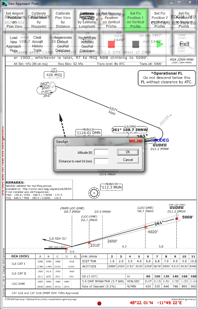 Input height fixes on the vertical profile |
 Main window, with buttons to geo reference the chart |
Once you have done the first few plates all this takes around 2‐3 minutes, plus the time taken to find the approach plate. Finding the approach plates isn't too hard if you are an on‐line flyer, but if you struggle there are some web links at the end of the manual. Google searching 'XXXX approach charts' usually works too.
Using GeoApr
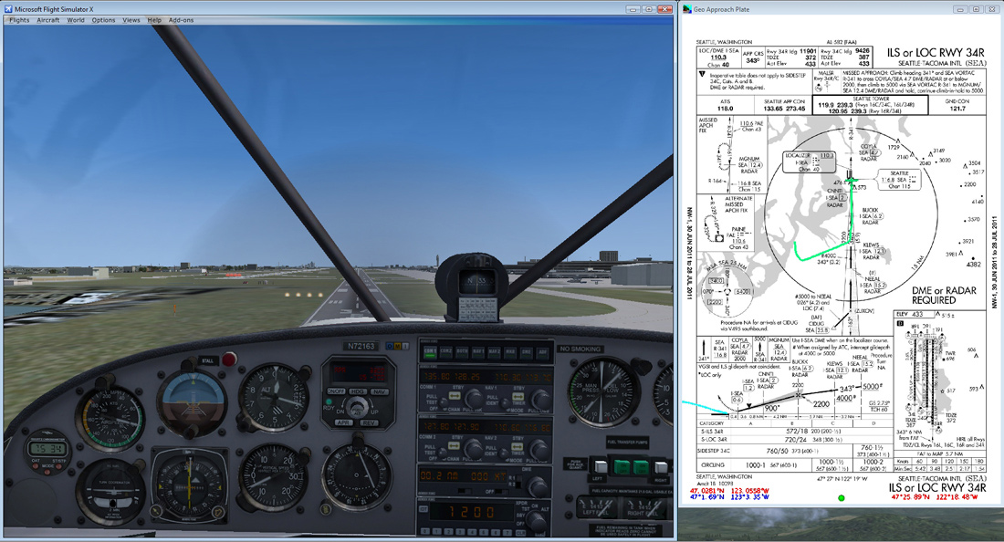
One of the main drawbacks I have found is that you cannot load a separate smaller window within FSX that has the approach chart showing in it, something which you were able to do with SimCharts. The easy solution is to resize your FS window to about 75% and put it alongside the approach chart, but unless you are using a wide‐screen monitor this may not be an option. If you have a 2nd computer on a LAN you can run GeoApr on there, details of how to do so are included in the manual.
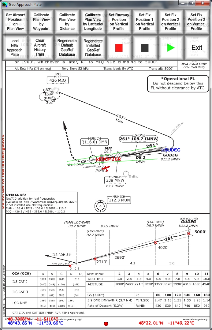
Once GeoApr has loaded with the relevant approach plate a green
dot will appear at the bottom of the window to show that it is
connected to FSX. All you need to do now is wait until you are
within the range shown on the chart and your aircraft will show
up, followed by a green trail (the colour
can be changed if you don't like green). From here on in you just
need to follow the chart and fly the aircraft then have a look at
how you did after landing. Provided that you have calibrated the
chart correctly you should be able to accurately see your flight
path. The vertical profile tracker I really like as it's a great
tool to see how you flew that glide path. If you reference 3
height fixes on the vertical profile and any deviation from the
glide‐path will show up. Try flying half the approach on
auto‐pilot and half manually, and it's very easy to distinguish
between the two!
 Approaching via the NDB |
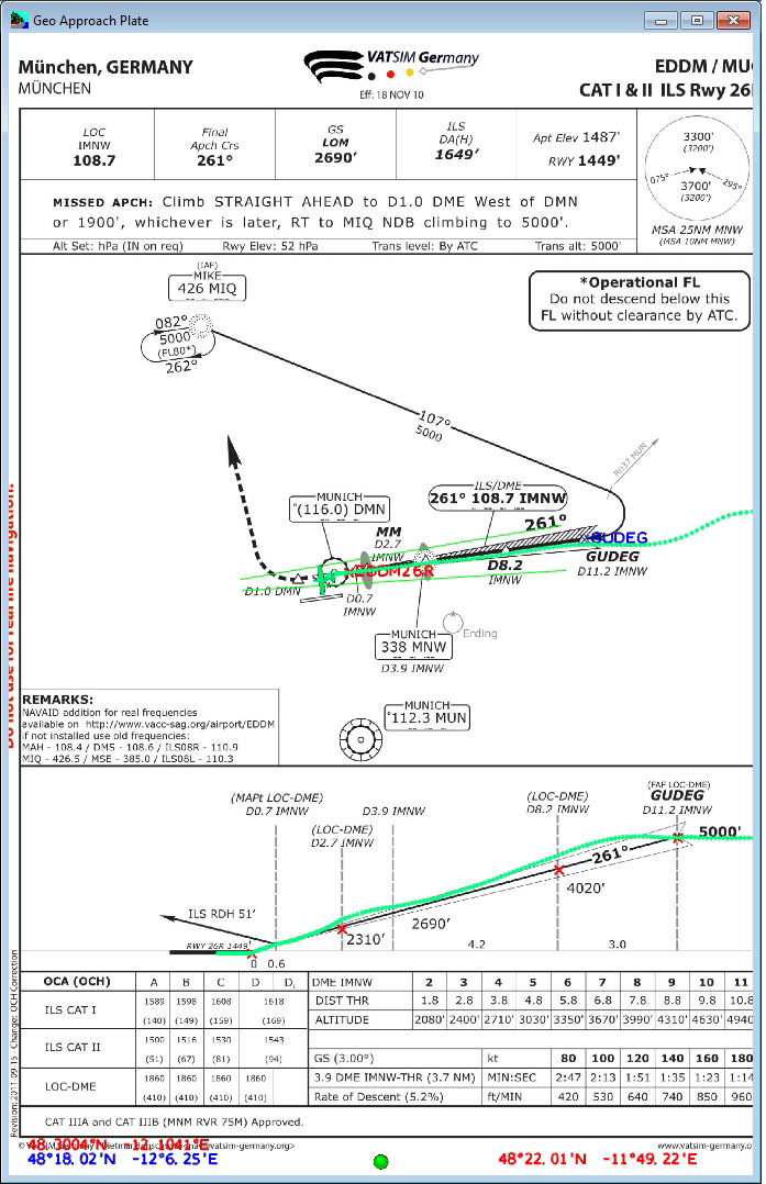 Not quite on track |
 All good so far |
Tracking is spot on |
What Is The Point?
You may wonder what the point is of GeoApr, after all you can program the FMC of your 747 to fly the approach perfectly every time. But where's the fun in that?
I've found using GeoApr very useful as a training aid and it is a massive help to be able to visually track what you are doing in real time. If I am given an NDB approach by the controller I no longer have to scratch my head thinking about which way to go etc... as I can see my aircraft's position on the chart and make the turns accordingly. Using GeoApr over the last few weeks has certainly improved my piloting skills massively when it comes to NDB and VOR approaches. I've now found myself looking for the harder approaches to give myself more of a challenge and some more fun – isn't that what desktop flight simulation is all about?
If you want to watch back your approach in real‐time you can record it and play it back to see where you could improve. You may have arrived at the threshold too fast and too high, the video playback might help you determine where it all went wrong.
Cons
There are a few cons that I have found (some already listed above):
● Some charts do not want to geo‐reference correctly. Most of these seem to be landscape orientated charts, of which there aren't many that I
have come across yet.
● Some charts when converted turned black – these were all from the same website
● Unable to run within the FSX window
● Lack of charts included
But the pros far outweigh them, so do not let these put you off.
![]()
Verdict
This is a great
little utility that has FSX has needed for a long time. You will
only really get the best use from it if you regularly need to
consult approach charts. If you are one of these simmers then
GeoApr should be a strong contender to be your next purchase.
The interface is very easy to use and any problems can be
remedied by consulting the very comprehensive and thorough
manual. It's not a utility that I feel casual VFR fliers will
get a great benefit from, so that is worth bearing in mind if
you fall into that category.
There are a few drawbacks, but on the whole they are fairly
insignificant.
I award Flight1 GeoApr a Mutley's Hangar Score of 8/10
![]()
Rob Scott
Review machine Spec: Intel i7 2600k @3.40GHz | 8GB DDR3 RAM 1600MHz |NVidia GTX570 1280MB GFX Card |Windows 7 64bit Home Premium
 |
System Requirements
|