Hardly a week goes by without the MegaSceneryEarth team releasing
a new scenery area of the US. Mutley’s Hangar has decided to take
a look at some of these sceneries to see what they have to offer
and if they are as good as the press releases say…..
Choose --> Buy --> Download --> Fly
It really is as simple as the website suggests, what they don’t
mention however is the time it takes to download the scenery. The
download for Illinois alone is over 15GB and comes as several
separate files, which does make it easier to re-download a section
should something odd happen during the download, as it did to me.
It took me close to two days to get everything downloaded and
installed, a couple of the downloads were corrupted each time I
tried to open them, eventually though I managed to download all
the files. I cannot be sure if these errors were a problem with my
internet connection or the download itself, I suspect it is more
likely to be my internet connection. The package is also available
as a 5 disk DVD set for an extra $10.
 O'Hare from above |
 Departing O'Hare |
Once all the files are downloaded the installation process is automated and puts the relevant files in the correct places to enable you to get up in the air with the minimum of fuss. What isn’t included through is a set-up manual, which I found odd…
What Do You Get?
Documentation
The reason I find it odd that a set-up manual wasn’t included is because the documentation which is included is superb:
the ILS frequencies didn’t agree with those in FSX
All the information which could be provided in a manual is provided on the http://www.megasceneryearth.com
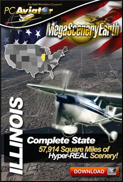
Price & Coverage Area
At the time of publication, the price for this add-on is $39.95, which is around £25 or €30 and it covers a massive 57,914 square miles; almost 3 times the size of Wales. I think that is excellent value for money, especially if you are a VFR pilot.
 Coverage area |
 Not as impressive at this altitude |
Let’s Fly!
When I first loaded up my aircraft at Chicago O Hare airport I must admit that I wasn’t bowled over by what I saw. The land for as far as the eye could see was entirely flat. However, once I was in the air it was a totally different story…
 Feeling a little flat |
 It's just too flat |
The scenery has a detail of 50cm/pixel throughout the whole region, which partly explains the massive download size. Once you are up in the air the views are fantastic and ultra-realistic, as the product page promises. It’s very easy to navigate via roads and other visual reference points to get to your destination.
 VFR Navigation is so easy |
 River snaking it's way through the land |
When you get closer to the ground however the scenery can begin to look a little distorted because the buildings which appear to be 3D from the air all of a sudden are flat. This will only be a problem if you plan spending all of your time flying at 500ft. I flew most of my flights at around 5,000 feet and had no problems navigating using the Mk1 eyeball.
There are a few 3D objects scattered around the scenery to help make it a bit more interesting, but as they are so few and far between they look a little out of place when they do come into view. The great thing about not having any autogen or many 3D objects in the scenery is that the performance is fantastic. I actually noticed an increase in my frame rates compared to flying over the default scenery, which made for an ultra-smooth flight.
 3D Objects look odd on their own |
 Things get a little distorted the lower you get |
If you want to experience Illinois through all the seasons you are going to be disappointed as there is only one set of textures included, but to be fair they are fantastic and I cannot see anyone getting bored with them, night textures also aren’t included. Just imagine how large the download would have been if all four (or five) season were included! The state boundaries are very obvious when crossing between them, although if you own the surrounding states you won’t notice.
 Anyone got a torch? |
 Fantastic visuals |
In total I’ve probably spent 15-20 hours exploring this scenery and have only really scratched the service due to it’s size. It would take a long time to explore every square mile of it.
Conclusion
This MegaSceneryEarth product looks every bit as good as the product page promises it will be. There are a few compromises which you will have to make; lack of autogen and 3D objects, but on the flip side the performance level in FSX increases massively. I’ve flown lots of short flights in simple and complex aircraft and at no point did FSX start to struggle. If your system can handle the default scenery without any problem it should be able to handle MegaSceneryEarth Illinois. I’ve enjoyed reviewing this product and would strongly recommend it to anyone who wants to explore Illinois in more detail. Unlike other scenery add-ons it doesn’t matter what aircraft you use to explore it because the coverage area is huge.
![]()
Verdict
|
•
Level of detail: • Performance: • Scenery Coverage: • Quality of Buildings: • Documentation: • Value for Money: |
10/10 10/10 10/10 n/a 9.0/10 10/10 |
 |
Mutley's Hangar score of 9.5/10
Rob Scott
Review machine Spec: Intel i7 2600k @3.40GHz | 8GB DDR3 RAM 1600MHz |NVidia GTX570 1280MB GFX Card |Windows 7 64bit Home Premium