Mutley's Hangar Big VFR Adventure
LEG 5: EGFG-EGCW (Swansea-Welshpool)
In many respects, this was the most enjoyable
flight so far, probably because the winds were nice and calm. After
looking out of my window here in Pontefract I could see many light
aircraft in the sky, no doubt coming and going from the local Sherburn
Aero Club.
This was a good sign that it was a nice day for flying, so without delay
I fired up FS, planned the route and jumped into the fabulous C206U
Stationair (also available from Just Flight and reviewed on Mutleys'
Hangar here !
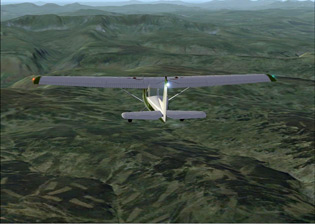
After passing Snowdonia National Park all
that we could see were the green fields of the farmers with the odd
outbuilding scattered around the fields. It would be great if
there was some way we could incorporate some tractors, lambs and sheep
moving around the fields, it is spring after all!
As the airfield at Welshpool came into view I began to descend down to
2,500 feet for the pattern as we would be landing on runway 22. Our turn
to base was easily marked out by a big hill which was right on the
Welsh-English border, I didn’t want to get too close to that.

On arrival at the airport I was surprise by the detailed scenery on
show, then I remembered that a while ago I had downloaded Alf Denham’s
VFR airfields from AVSIM with the intention of visiting them all, it’s
funny how things work out.
With only Caernafon and Liverpool left to visit on this tour of VFR Real
Scenery Volume 3, I thought it would be best to taxi to the maintenance
area and get the aircraft checked over before I headed off on the rest
of the journey.
LEG 6: EGCE-EGCK (Welshpool-Caernafon)
Unfortunately the C206 has suffered what looked
like a bird strike on one of the landing gear struts during the last
flight, so she was grounded for the rest of the day until it was fixed.
Fortunately I got chatting to a guy in the hangar who had just come from
Caernafon in a C152 and was hoping to make his way back down to Mutley
Field. He agreed to swap our aircraft as the fast cruise speed of
the C206 appealed to him, so we swapped and I was to take the C152 back
to Caernafon, lucky that isn’t it!
Again due to the lack of navaids this would be a direct flight which
would take me north west over the slate mines of Ffestiniog (where I
visited on holiday once) before making some gentle turns to avoid the
hills as we line up for finals.
It turns out that today was a great day for flying in this region, the
winds were calm and the sky was clear, which is great for viewing this
VFR scenery. As this was a sunset flight the greens of the fields were
spectacularly lit up as the flight progressed, as the pictures show.

The flight itself was fairly uneventful, but the scenery was
spectacular, the rest of England has a tough act to follow after this
short tour around South-West England & Wales.
I could stay in the air for hours just exploring this scenery,
accompanied by GMap I will never be lost as if I can find a main road on
the map, it will be there in the scenery.
After clearing the slate mines we dropped down from 4,500 feet to
pattern altitude of 1,500 feet and announced our landing intentions,
thankfully there was no other traffic to worry about. I manoeuvred so
that we were able to fly a long finals along the coast line and take in
the spectacular sunset as we came to the end of another days flying.
After a gentle landing it was time to head off to the hangar for a well
earned drink.
LEG 7: EGCK-EGGP (Caernafon-Liverpool)
This would be the final leg of the Volume 3 scenery area and I opted to
take off from Caernafon and fly around the Isle of Anglesey before
heading back to Liverpool. The route would take us all the way along the
coast, so for the best view make sure you are sat on the right side of
the aircraft.

We took off from runway 2 at Caernafon, for some reason the Rescue Pilot
scenery was not showing at the airport, so it was rather quiet there!
I had planned to fly at 5,500 feet, but clouds restricted me to 2,500.
The visibility wasn’t great for flying, but the aim was to arrive into
Liverpool at sunset. As we cruised over Anglesey everything was how I
remembered it from many holidays to this region, lots of fields and very
green.
We passed Southstack which is famous for its RSPB reserve which is home
to many varieties of bird, including Puffins. This area of coastline is
perfectly represented in the scenery with steep cliffs surrounded by
lots of fields, unfortunately there were no birds.
Continued .....


