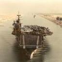
CV60 9 Posted April 7, 2019 Author Report Share Posted April 7, 2019 Here are some real-world images of some of the places I flew over in leg 13: Website of Gulf Coast Aerial Photography. This is worth looking at for some nice real world photography of the places I traveled on this trip: http://texascoastgeology.com/misc/misc.html Ground Level Panorama of Padre Island. (Image Credit: Me) USS Lexington Link to post Share on other sites
CV60 9 Posted April 7, 2019 Author Report Share Posted April 7, 2019 (edited) 7 April Preflight Well, that was a quick preflight. Staring at darkening skies doesn't take much time..… Looking at the TAFs, I may be able to try a short leg around 4 PM local time today. Edited April 7, 2019 by CV60 Update planning Link to post Share on other sites
CV60 9 Posted April 8, 2019 Author Report Share Posted April 8, 2019 (edited) Leg 14 pre-flight and flight -07 April 2019 Kransas County (KRKP) to Scholes International Galveston (KGLS) As predicted, in late afternoon, the weather improved to MVFR conditions as the front moves to the north east and out of the area. While the ceilings are marginal, the weather forecast for tomorrow isn't particularly good, and I'm getting itchy to fly. Plus, I'm hoping to get further north, as the flying weather here hasn't been good the past couple of days. Based n the weather reports, it looks like I can get to Galveston, TX before the weather starts deteriorating to IFR conditions. According to the forecast discussion "[l]arge line of thunderstorms moving across the majority of the terminals this hour. Expect variable winds to 40 knots in gust, conditions falling to LIFR within locally heavy rain. +TSRA line should be east of the air fields by 19Z or 20Z, possible light rain lingering behind system through the late afternoon. Westerly winds and overnight high end MVFR or low end VFR ceilings through Monday sunrise." Aviation Forecast Current Weather Conditions Terminal Area Forecast 08 0025Z April Since I will simply be flying up the coast to Galveston, and I'm burning daylight, I dispense with creating a VFR chart using a sectional chart. My planned take off time is 1700L/2200Z, with a projected landing time at 1830L. The .kmz of the flight can be downloaded here: https://we.tl/t-sXXDrlWfNP I got off the ground at 1712 local/2212Z. I had a nice 17 knot tailwind for a lot of the trip. At times during the flight, the ceilings were lower than I had expected, lowering to 1900 feet. Fortunately, the coastal terrain is low, and there were few towers, so between descending to 1200 feet and weaving between a few clouds, the lowering ceiling wasn't too much of a problem. The landing at Galveston was one of my better ones in the Stearman. I believe it was a 3 point touchdown, which for me is rare..... Image 1 Haze during Deaparture 2216Z Image 2 Looking South toward Ballou Island 2220Z Image 3 Looking towards Grass Island south of Seadrift, TX 2229Z Image 4 Looking North 6nm W of Port OConner TX Image 5 Shipping Channel to Matagorda Bay 2240Z Image 6 Lowering ceiling S of Matagorda TX Image 7 Lowering ceiling SW of Sargent TX 2303Z Image 8 One nm W of Lake Jackson TX 2312Z Edited April 8, 2019 by CV60 Link to post Share on other sites
mutley 4,487 Posted April 9, 2019 Report Share Posted April 9, 2019 Kudos for your stamina Steve, you are doing a great job! Cheers, Joe Link to post Share on other sites
CV60 9 Posted April 9, 2019 Author Report Share Posted April 9, 2019 12 minutes ago, mutley said: Kudos for your stamina Steve, you are doing a great job! Cheers, Joe Thanks. I wanted to showcase some of the natural beauty of the US in this virtual adventure. Plus, I'm virtually exploring places I would like to see in real life in the next couple of years, so this is a bit of a "recce flight" for me. Link to post Share on other sites
CV60 9 Posted April 16, 2019 Author Report Share Posted April 16, 2019 Leg 15 pre-flight and flight -09 April 2019 Scholes International Galveston (KGLS) to Harrison County (Texas) (KASL) Today's flight is to take me to the North eastern corner of Texas, just east of Shreveport, Louisiana. (Image 1). I'll try to get off the ground by 1900Z/1400L, as it is a 210 nm flight. The weather looks good. Low winds and clear skies for the entire route. The winds at 3000 feet are predicted to be from the North or NW at only 5 knots, so headwinds won't be a significant factor on this leg, which is nice given the distance I'm flying. The TAFs are also very nice-only 5 knot winds expected at my destination. METAR 091800Z April Terminal Area Forecast 2207Z April WInds Aloft, 3000 foot 091800Z April I took off at 1910Z, only ten minutes late. The weather was as forecasted, and the trip was uneventful until my landing, when I had to go around due to an GA aircraft that decided to enter the runway as I was on final. Aside from that brief bit of excitement, the trip was pleasant. The .kmz file can be downloaded from here: https://we.tl/t-fDotAHccpp Of note, I forgot to begin recording the .kmz file until I was near San Augustine, TX, so about one half of the trip was not recorded in the .kmz file. Image 1 Looking South at Galveston, TX 1918Z Image 2 West of Port Bolivar TX 1918Z Image 3 Approaching Ivanhoe TX 2017Z Image 4 Sam Rayburn Reservoir near Zavalla, TX 2042Z Image 5 Tenaha TX 2115Z Image 6 Approaching Marshall TX 2209Z Link to post Share on other sites
CV60 9 Posted January 4, 2020 Author Report Share Posted January 4, 2020 With A2A's release of the Piper Cub for P3Dv4, I will pick up this adventure in my brand-spanking new J-3. Stay tuned..... Link to post Share on other sites
mutley 4,487 Posted January 7, 2020 Report Share Posted January 7, 2020 The A2A Piper Cub is awesome! Have a good journey and I'm looking forward to your pics! Link to post Share on other sites
Hook 0 Posted January 7, 2020 Report Share Posted January 7, 2020 I've been waiting a long time to get the new A2A Cub and for you to continue your adventures. I do love me some A2A Cub. I'm currently flying the reverse route depicted in the book Flight of Passage. I already did the flight a long time ago, now I'm taking the Cub back home. I started in California and my next flight will be over Dallas. Easy navigation using highways: 8, 10, 20, 30, 40, 81 and I'm not restricted to whatever path the author took to get to California. Good luck! Hook Link to post Share on other sites
CV60 9 Posted January 12, 2020 Author Report Share Posted January 12, 2020 (edited) Leg 16 pre-flight and flight 08 January 2020 Harrison County (Texas) (KASL) to Natchitoches, Louisiana (KIER) With the release of A2A's Piper J-3 Cub, I've decided to resume this little jaunt across the country. Today's flight is simply to get the Cub repositioned along the Gulf Coast. I plan on flying along it and into Florida for most of January, and begin to venture back north into Georgia and the Carolina's in late winter and early spring. The flight today will be brief, covering only about 90 miles, as real life has delayed my departure until 3:30 PM. Consequentially, I will only have about 120 minutes of flying time before nightfall. Route: KASL-KIER National Weather, Aviation Weather and METARs There is some weather coming in from Texas, but it won't get to where Louisiana until tomorrow. METARs show VFR conditions throughout my route, and the terminal area forcast that conditions will remain VFR. METAR: KASL [Marshall/Harrison Cn] METAR: KASL 082115Z AUTO 16008KT 130V190 10SM CLR 18/M02 A3025 RMK AO1 T01831022 METAR: KIER [Natchitoches Rgnl] METAR: KIER 082115Z AUTO 12010G14KT 10SM CLR 19/00 A3029 RMK AO2 T01870003 The one thing that concerns me is the winds. Winds aloft are predicted to be around 25 knots from the south at 3,000 feet. In my little 65 hp J-3, that could significantly increase my time aloft. Although I would really like to get further south, I decide to take the better part of valor and just get as far as Natchitoches. I will also fly the route at 2500 feet, to try to minimize some of the wind. This is far below the 11,000 foot freezing level, so I won't have to worry about icing. (Not that I would anyway, as the skies are clear today). Edited January 12, 2020 by CV60 Format Link to post Share on other sites
CV60 9 Posted January 12, 2020 Author Report Share Posted January 12, 2020 (edited) The flight was uneventful. Climbing out of Harrison County airport, the winds buffeted the Cub, but it settled down once I reached my cruise altitude. The flight was uneventful, and I made an straight in approach with a decent landing on Runway 17 at Natchitoches at 1703 local. My lack of recent stick time in the Cub, combined with some wind gusts, caused me to "float" the Cub a little farther down the runway before I touched down. Images are below: Image 1 Over Panola, TX Image 2 Approaching CE 'Rusty' Williams airport (3F3) Image 3 Over Black Lake, Louisiana Image 4: Over the Red River, approaching Natchitoches Edited January 12, 2020 by CV60 Link to post Share on other sites
CV60 9 Posted January 12, 2020 Author Report Share Posted January 12, 2020 Here are some real-world images from some of the areas I flew over on this leg: Cotton Field near Natchitoches (Source: https://www.visittheusa.com/destination/natchitoches) Black Lake, LA Link to post Share on other sites
mutley 4,487 Posted January 14, 2020 Report Share Posted January 14, 2020 Looks like a beautiful area, nice flight Link to post Share on other sites
CV60 9 Posted January 14, 2020 Author Report Share Posted January 14, 2020 (edited) Yep, it is pretty. This whole part of the US is nice, scenery wise. Weather-wise? Notsomuch. At least today: Its been like this the past couple of days, and looks like it may last until Friday, so there won't be too many updates in this trip until then..... Edit: From the Forecast Discussion: IFR/LIFR conditions will hang around the Four-States region over the next 24-hours. A frontal boundary has stalled across the area, allowing for winds to decouple, and moisture to pool area wide. This will result in low cloud decks (and fog headed into tomorrow morning) to blanket the region. KTYR is the only site expected to reach MVFR this afternoon past 14/23z. All TAF sites can also expect either VCSH or SHRA during this period due to the unstable airmass overhead. /44/ Edited January 14, 2020 by CV60 Link to post Share on other sites
mutley 4,487 Posted January 14, 2020 Report Share Posted January 14, 2020 Yuck! Link to post Share on other sites
CV60 9 Posted January 16, 2020 Author Report Share Posted January 16, 2020 (edited) No flying today. Too much "Terrain Obstruction Orange" on this picture: The forecast discussion doesn't look good, either. Possibly I'll get a chance to fly this weekend: Low clouds and fog blanketing the area again this morning ahead of an approaching CDFNT expected to sag slowly south through the region today. Expect VSBYS to improve mid morning or so, with CIGS slower to improve, lifting to IFR mid to late morning and perhaps MVFR for a time this afternoon. Isolated to scattered showers are possible with the front, and a combination of vicinity and PROB groups were carried to convey this activity along with the potential for IFR CIGS to linger and the coastal sites. SFC winds will increase from the NE with the passage of the front, which will help mitigate VSBY reductions tonight, though low CIGS will continue to be a concern through the evening and into the overnight. Edited January 16, 2020 by CV60 Link to post Share on other sites
CV60 9 Posted January 18, 2020 Author Report Share Posted January 18, 2020 (edited) Still no flying today, at least until this afternoon. A lot of rain in the Natchitoches area right now, and ceilings around 1000-1300 feet. The forecast (reproduced below) indicates clearing skies. Possibly I will be flying later this afternoon, but most likely not until tomorrow. For the 18/12Z TAF period, IFR/LIFR cigs plague all sites this morning as low level moisture surges north ahead of a cold front. Scattered to numerous showers will continue through much of the morning with some isolated thunderstorms possible later today as heating occurs ahead of the approaching cold front. Breezy S/SW winds will veer W/NW with the arrival of the front as speeds increase to between 12-18 kts with higher gusts near 20-25 kts. Convection will gradually diminish from NW to SE through this afteroon into the early evening hours as the front clears the region. Skies will also begin clearing as well with SKC taking hold across all sites during the latter half of the TAF period. Wind speeds will drop off slightly after 19/00Z to around 10 kts on average from due north. Edited January 18, 2020 by CV60 Link to post Share on other sites
CV60 9 Posted January 20, 2020 Author Report Share Posted January 20, 2020 Leg 17 pre-flight 19 January 2020 Natchitoches, Louisiana (KIER) to Lafayette Regional (KLFT) The rain has finally stopped, and the clouds have finally moved on to Georgia. This gives me an opportunity to get the Cub a little closer to the Gulf Coast. Image 1. National weather 19 January Clear skies, with a strong wind from the north is now centered on Louisiana. Most stations are calling for 20-25 mph winds. Image 2. Aviation Forecast 19 January 2020 Image 3 METAR Central Louisiana METAR: KIER [Natchitoches Rgnl] METAR: KIER 191815Z AUTO 04009G17KT 10SM CLR 11/M05 A3051 RMK AO2 T01121052 METAR: KLFT [Lafayette Rgnl] METAR: KLFT 191753Z 02020G28KT 10SM CLR 11/M04 A3042 RMK AO2 PK WND 02028/1753 SLP299 T01111044 10111 20067 50006 Terminal Area Forecast KLFT [Lafayette Rgnl] TAF: KLFT 191722Z 1918/2018 02018G25KT P6SM BKN250 FM200000 01010KT P6SM SKC Winds Aloft (Extracted from FBUS31 KWNO 191354) FD1US1 DATA BASED ON 191200Z VALID 191800Z FOR USE 1400-2100Z. TEMPS NEG ABV 24000 FT 3000 6000 9000 12000 18000 24000 30000 34000 39000 LCH 0446 3620+06 3020+06 2825+01 2831-14 2843-28 257442 258748 268352 SHV 0130 3627+00 3119-01 2932-03 2852-16 2855-28 265344 265352 267752 Forecast Discussion: For the 19/12Z TAF period, VFR prevailing with SKC conditions through much of today. Some mid/high level clouds may return late in the period, and any cigs that result will remain above 10Kft. Breezy north winds averaging near 10 kts will prevail today, then dropping off closer to 5 kts or less by 20/00Z as high pressure at the sfc continues to dominate. This tailwind will make the 118 nm flight to KLFT elateively quick. My preflight calculations are that it will take only 94 minutes. I'm going to try to keep the Cub below 2500 feet, as the winds aloft may be in the 30 mph range. I may climb higher to get better screenshots (my scenery looks best if I'm above 3000 feet), but generally I'm going to try to stay relatively low this flight. Figure 4. KIER to KLFT Link to post Share on other sites
CV60 9 Posted January 20, 2020 Author Report Share Posted January 20, 2020 (edited) Leg 17 Flight 19 January 2020 Natchitoches, Louisiana (KIER) to Lafayette Regional (KLFT) Kmz file of flight here: https://we.tl/t-OEtVhDYy9U The flight was good. Take off was at 1937Z, with landing at 2118Z. Weather was as predicted, with high winds from the North. The only incident of note was that I had a close approach west of Forest Hill, LA with a small passenger jet wile flying at 3,500 feet. The jet crossed approximately 3/4 mile in front of me was heading south west and descending. It may have been heading for KACP, but it was fairly low for being that far out (20nm). The high wing of my Cub prevented me from seeing the jet until it was at my 10 o'clock position, and I had my radio off to conserve its battery power, so I was unaware of the jets presence. I may start recording these flights in TACVIEW so I can see what some of the air traffic is doing. The landing on Runway 4L at KLFT was fun-winds were 029 at 17 knts. Effectively, the Cub was flying at about 11 knots over the ground on touchdown, and ended up stopping almost immediately on touch down. The wind was high enough that I almost ground looped the Cub trying to taxi to the general aviation parking. I definitely need more practice taxiing! Below are some screenshots of the flight: Image 1. 1947Z Crossing the Red River SE of Natchitoches Image 2. 1952Z Over Montgomery LA Image 3. 1957Z Natachie Lake and Red River Image 4. 2023Z Over Alexandria LA Image 5. 2043Z Near St Landry Parish KOPL Image 6. 2108Z Approaching KLFT Edited January 20, 2020 by CV60 Link to post Share on other sites
CV60 9 Posted January 23, 2020 Author Report Share Posted January 23, 2020 Leg 18 pre-flight 22 January 2020 Lafayette Regional (KLFT) to Louisiana Regional (L38) Weather looks good right now for the flight to Louisiana Regional. I'm taking a roundabout route to L38. If it were a direct flight, it would only be about 55 nm. However, I'm going to fly a somewhat circuitous 177 nm route over some of the Louisiana Bayou country. Image 1 KLFT-L38 I began my pre-flight at 1615Z. The weather at that time looked good. There is some weather moving in from Texas, but it should still be to my west by the time I land. Image 2. National Weather 221800Z Jan 2020 Current conditions at the departure airfield (KLFT) are good. At the few clouds at 2000 feet, 10 mile visiblity and winds 080 at 7 knots: METAR: KLFT [Lafayette Rgnl] METAR: KLFT 221553Z 08007KT 10SM FEW020 06/M01 A3031 RMK AO2 SLP264 T00611006 Freezing levels are in the 7000-9000 foot range, so I won't have to worry about any icing at my expected cruise altitude of 2500 feet. The Terminal Area Forecast shows that most of the area will be VFR at my expected landing time of 2030Z (Image 3), although the leading edge of the front will be moving into western Louisiana by then. Image 3. Terminal Area Forecast, 222021 Jan 2020 Winds at 3000 feet are predicted to be 20 knots from the south, so my plan to fly the Cub for 177 nm without refueling may need to be revised. With those kind of headwinds, I'll be lucky to make the entire route. I will make the refueling decision before I enter the Class C airspace around New Orleans. After completing my preflight, real life intervened, delaying my departure until 1917Z. The TAFs still show VFR conditions, but the front is clearly moving into the area (Image 4). Image 4. Radar 221820Z Jan 2020 Link to post Share on other sites
CV60 9 Posted January 24, 2020 Author Report Share Posted January 24, 2020 (edited) Leg 18 Flight 22 January 2020 Lafayette Regional (KLFT) to Louisiana Regional (L38) .kmz file here https://we.tl/t-9S7KasHj0j (KLFT-L49) and here: https://we.tl/t-b0mOAujltI (L49-L38) My take off was at 1917Z. The first leg of the flight was uneventful. Some lowering visibility near Centerville, LA required me to to descend to 2000 feet for about 10 minutes . As I suspected, the Cub didn't have enough gas to get to L38, so I set down at Galliano Airport (L39) at about 2135Z to refuel. After getting airborne again, the flight to L38 was uneventful, and I landed at 2300Z, with about 30 minutes of daylight to spare. My landing at L38 was terrible, but my excuse is that my computer video seemed to be acting up, and my head movements weren't being tracked by the Track IR. Sometimes that seems to happen on long flights, especially if I'm doing a lot of view switching. Photos are below: Image 1. 1921Z Departing Lafayette-KLFT Image 2. 2112Z La Rose Louisiana Image 3. 2008Z KPTN Patterson Image 4. 1937Z Approaching Dauterive Lake Image 5. 1950Z Over Fishers Island Image 6. 2002Z Lowering clouds near Centerville LA Image 7. 2101Z Madison Bay near Montegut LA Image 8. 2210Z Near Lake Cataouatche-New Orleans Image 9. 2215Z Near Lake Cataouatche-New Orleans Image 10. 2236Z Approaching Oak Alley Image 11. 2246Z Descending to enter the pattern Rwy 17 Louisiana Regional L38 Edited January 24, 2020 by CV60 Link to post Share on other sites
CV60 9 Posted January 24, 2020 Author Report Share Posted January 24, 2020 (edited) Real World Photos of Legs 17-18 (KIER-KLFT-L38) Starting out on Leg 17, I flew along the Red River. The Red River is a different from other inland rivers in that it is brackish, deriving its salinity from crossing over salt domes in Texas. Image 1. Red River Salt Deposits (Note: Photo taken in Texas, not Louisiana) Source: Wikipedia Although the Red River is navigable, it wasn't always so. Until the 1870's it was blocked above Alexandria, LA by "the Great Raft", an approximately 100 mile long log jam. In In 1833, Captain Henry Shreve, (whom Shrevesport, LA is named after) began to clear the jam, a process that ultimately took forty years to complete: Image 2 The Great Raft After departing Natchitoches, I flew over several sections of the Kisatchie National Forest, a forested national park that is typical of the landscape of Louisiana in the 1800’s: Image 3: Kisatchie Bayou, Kisatchie National Forest. Source: https://www.louisianatravel.com/articles/guide-kisatchie-national-forest I also flew over Lake Fausse Pointe State Park Image 4. Lake Fausse Pointe State Park (Source: https://www.facebook.com/pg/Lake-Fausse-Pointe-State-Park-164514710265460/reviews/) Flying toward the coastal areas near Montegut, LA, I flew over Pointe aux Chenes State Wildlife Management Area. Image 5. Pointe aux Chenes State Wildlife Management Area (Source: https://shop.andycrawford.photography/warehouse/art_print_products/pointe-aux-chenes-morning-star) And after refueling, I flew over the Jean Lafitte Historic District and the Oak Alley Plantation: Image 6: Jean Lafitte Park (Source: https://www.christopherryan.com/jean-lafitte-national-historical-park-and-reserve/) Image 7: Oak Alley Plantation. Source: Me Edited January 24, 2020 by CV60 Link to post Share on other sites
CV60 9 Posted January 26, 2020 Author Report Share Posted January 26, 2020 26 January 2020 No flying today. At least not to the east.... 1 Link to post Share on other sites
CV60 9 Posted January 29, 2020 Author Report Share Posted January 29, 2020 (edited) Leg 19 pre-flight 28 January 2020 Louisiana Regional (L38) to Vicksburg Regional (KVKS) Today's flight will take me partway up the Natchez trace, a route used by American Indiana and settlers in the 18th and 19th centuries. My route will generally be in a northerly direction, about 10-15 nm east of the Mississippi River. Navigation will be relatively simple, as the route will generally follow US Highway 61, a 4-lane road. Image 1. L38-KVKS A front coming from the west is bringing rain to Louisiana and western Mississippi. While the weather is cloudy, the next day will bring rain and decreasing ceilings, so I'm going to have to fly today if I'm going to get this flight done in the next few days. The forecast discussion is below: Jackson, MS: VFR conditions prevail at all TAF sites but during late afternoon hours sites in the west like GLH will experience VCSH starting around 20Z as an approaching system from the west spreads into our region. Flight categories will vary throughout the TAF period especially site GLH as they will see lowering of ceilings earlier as an IFR cloud deck moves in from LA/TX. -RA will begin late tonight for central and eastern areas and eventually turn into RA tomorrow morning. Winds will be out of the east and shifting more SE around 06z./JNE/ Image 2. Aviation Forecast Radar shows the leading edge of the front is moving in the area. Fortunately, the freezing level is at 7,000 feet, and the obstructions are generally 1000 feet or lower, so I can easily avoid icing: Image 3 Radar METARs show my flight route is still VFR, but IFR conditions are moving in from the west: Image 4. METAR 28 2024Z Jan 2020 The Terminal Area Forecast indicates the VFR conditions will hold up until nightfall: Image 5. TAF 282148 Jan 2020 Edited January 29, 2020 by CV60 Link to post Share on other sites
CV60 9 Posted January 29, 2020 Author Report Share Posted January 29, 2020 (edited) Leg 19 Flight 28 January 2020 Louisiana Regional (L38) to Vicksburg Municipal (KVKS) .kmz file here: https://we.tl/t-aNJXlP3jTD (will be available for 7 days) Take off was at 1537 Local/2137 Z. I'm pressed for time to cover the 141 nm/132 minute flight before it gets dark. Sunset is at 1733L, with civil twilight ending at 1759L. That gives me only 12 minutes leeway to get on the ground at KVKS. During the flight, I had low winds from the south at 5-10 knots for most of the route. At several points during the flight I went through some light rain, but the ceiling remained above 5000 feet. I landed at 1743L/2343Z, aided by slightly higher tailwinds than expected. My landing was poor-I was high, and didn't touch down until I was far down the runway. Had I had more daylight, I probably would have gone around again. Photos are attached. Image 1. 282155Z Jan 2020 Mississippi River near Plaquemine Image 2. 282222Z Jan 2020 Near St Francisville looking west Image 3. 282238Z Jan 2020 Over Woodville, MS Image 4. 282311Z Jan 2020 Over Fayette, MS- WX deteroriating, ceiling lowering Image 5. 282321Z Jan 2020 Approaching Port Gibson, MS. Note Grand Gulf nuclear plant cooling tower in the distance Image 6. 282338Z Jan 2020-Approaching the pattern at KVKS at dusk Edited January 29, 2020 by CV60 Link to post Share on other sites
Recommended Posts
Please sign in to comment
You will be able to leave a comment after signing in
Sign In Now